Mt. Adams South Climb (2014-07-04)
Day 1 - Getting to Trailhead
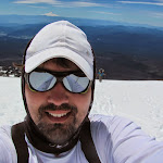
As much as I love beer, steak, and fireworks, I had different plans for this July 4th weekend. Since conditions were looking pretty good, Naren and I decided to tackle Mt. Adams. This climb went without a hitch, and we’ve met pretty much every timing goal we had set during the entire trip. It felt good to just know what we’re doing and plan everything ahead. While not the highest I’ve ever climbed (well, second highest, so still awesome), I think this is definitely the prettiest peak I’ve reached.
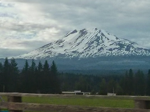
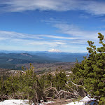
That was the view we were presented with on the way to the mountain. Mt. Adams is a pain to get to, since the drive typically involves going all the way into Oregon, then heading east, only to come back up north.
Peaking at a respectable 12,276 ft, Mt. Adams is one of the biggest mountains that’s reasonably driveable and not a technical climb; its south face has a non-glaciated route all the way to the summit. Early July is a really great time to climb it, because most of the route is still covered in snow. This actually makes the climb much more pleasant. Later in the season (e.g. mid-August), the snow line moves up in elevation, and most of the route is on boulders and rocks. I much prefer the consistency of snow.
In any case, we took off at around noon on Friday, July 4th, and eventually arrived at the mountain. The last 5-8 miles of driving are slow-going, on a poorly-maintained, windy gravel road.
After stopping by the ranger station in the Trout Lake area to get our permits, we got to camp at around 6:30pm (right on target), and got our tent setup at the trailhead.
The trailhead sits at roughly 5,500 ft, so we had a long way to go to reach the summit. It can be done in one day for those in great shape, but most people do it in two, which is what we did. Next time, we’ll go for the one day challenge. :)
Day 2 - Climbing to Lunch Counter
The next morning, we had some breakfast, packed up camp, used the restrooms at the campsite (last chance until poop-in-a-bag territory!!) and were on our way up.
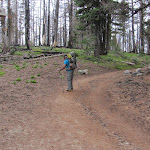
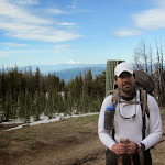

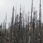
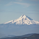
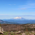
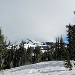
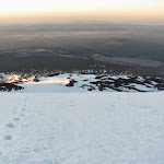
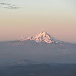
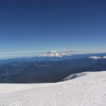
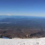
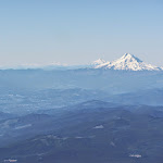
The hike up to base camp was pretty gorgeous, offering beautiful views of Mt. Hood and Mt. St. Helens. It was also a pretty good warmup challenge.

At this point, while we had a very clear day, the Mt. Adams summit was not looking too pretty. These mountains tend to break the mold and create whatever weather they feel like, on a whim.

What was awesome to see, though, was the determination of people no matter what. Here, we see droves of climbers, working to reach where ever they can reach, and hoping for things to clear up by the time they reach there. They are, no doubt, stepping in each other’s footsteps, which is why it looks like a line of ants.
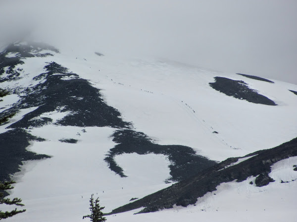
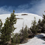
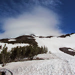
As it turns out, things never cleared up that day, and people were huddling up on Piker’s Peak (a false summit), waiting for things to look better. Going for the summit from Piker’s Peak is an additional hour and a half or so, and not necessarily the best idea in whiteout conditions.
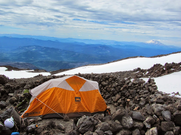
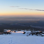
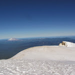
In any case, we eventually reached Lunch Counter, at roughly 9,500 ft. Lunch counter is a camp site, where there are many flat areas designed for tents, with rock walls built to shelter them from the elements. The wind was consistently coming from the west. We were able to find a pretty nice site, getting an entire rocky island all to ourselves. Our camp site offered really easy access to snow (for melting), some rock formations that were shaped like really uncomfortable toilet seats (think Game of Thrones, except it’s a toilet seat), and was pretty high up (less to climb tomorrow). Here is home sweet home:
It was around 5:30pm, so the rest of the time was spent on a few activities, such as melting snow for water. Naren was doing the melting and pouring, while I was doing the snow-shoveling and disinfecting with iodine tablets. After getting the water going, having dinner, and packing our bags for the next day, we headed to bed at around 6:30pm. It’s not easy to go to sleep when it’s still sunny out, and your backyard looks like this:
Day 3 - Summit Day!
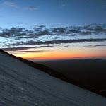
After discussing timing on the previous day, we decided to do a relaxed alpine start, and wake up at the tender hour that is 1:30am. It’s always nice to look outside the tent before turning on any lights, so you can get a glimpse of the mountain before your eyes adjust to the headlamps. To our great joy, we were greeted with a completely clear sky, stars shining nicely. I love the night sky, out in remote areas. I could see lights from what was most likely Portland, to the southwest, and a large field of randomly-blinking red lights to the southeast. I assume that was a farm of wind turbines. Looking around, there were maybe two other groups milling about, based on headlamp movement in the distance.
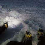
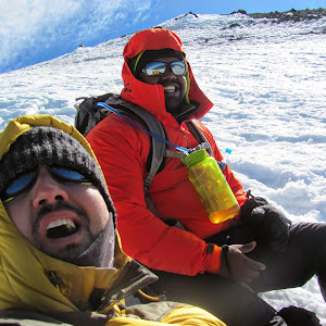
After breakfast, and an uncomfortable round of the aforementioned Game of Thrones, we did a quick gear check, making sure everyone had everything they needed, and off we went! We started moving in the dark at 3:00am. By 3:30am, we were near where things start getting steeper, so we equipped our crampons at that time.
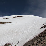
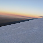
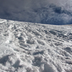
Rather than go straight up the mountain, especially when there weren’t any very fresh footprints to use, we worked on our box-stepping, and slowly zig-zagged up the mountain for an hour or two. Eventually, the sun started to come up, which is always one of my favourite parts of a climb. It feels like the scary darkness is over, and now things get real.
Right about here is where this climb gets more difficult. Steepness increases, and the air is a slight bit thinner. At this point, we had found some fresh footsteps from one group that passed us, and were using them as stairs going straight up, so we don’t need to keep kicking out the snow. Not having preexisting footsteps is actually fairly tiring. However, going straight up is also tiring, so we really slowed down and took our time. As always, it’s important to remember the old mantra, that this is a marathon, and not a sprint.
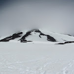
After what is the hardest push of this climb, we finally, at long last, arrive at…….. The false summit! Piker’s Peak, which is that thing that looked like the summit, engulfed in clouds in previous photos, is actually only at the 11,500 ft mark, and there is an additional 750 to climb. This is also where the wind really picks up. The wind isn’t too terrible while climbing afterwards, but this little area has pretty high winds. It was likely in the 40 mph range. Enough that heavy jackets will be lost if you don’t hold onto them tightly while not wearing them.
After a pretty short break here, we were on our way across a flat area, and back to climbing. Here is Piker’s Peak, from a few hundred feet up. You can see the footpath we took from there:
At this point, it’s not far. Here we are, goofing off while taking a break before the final push, and a shot up at what’s left to cover before reaching the easy hills to get to the final summit plateau.
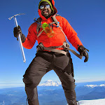
And finally, the summit!
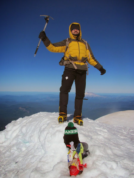
We reached the summit at around 8:45 am, so we made pretty decent time.
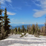
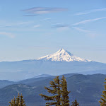
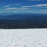
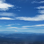
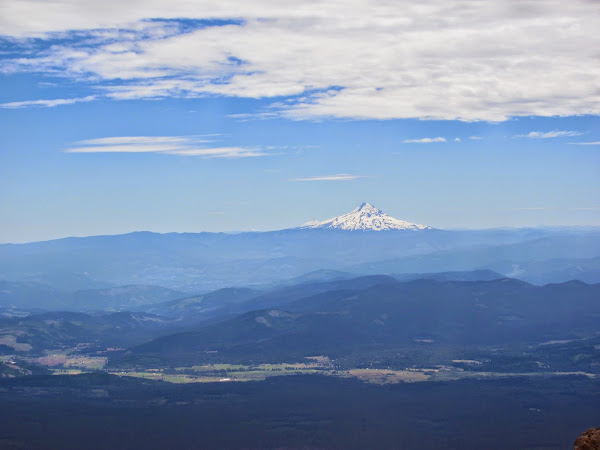
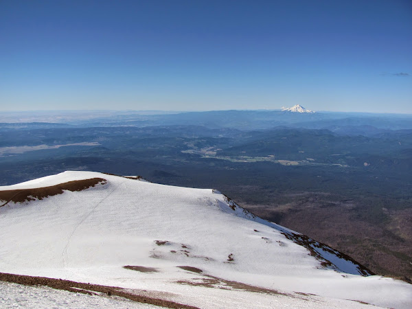
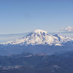
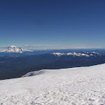
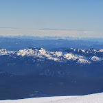
The summit offers absolutely majestic views all around! Rainier, St. Helens, Hood, and a few other usual suspects, all clearly visible. It was windy, but quite tolerable, and a great place to hang out for a bit. It wasn’t an ideal spot to have lunch or anything, so we took off after celebrating and taking some more pictures.
The most amazing thing is, we’ve only encountered three groups coming down from the summit. This means, assuming no mountaineers were attacking the tougher, glaciated routes on other faces of the mountain, we were the fourth group up and down the mountain on that day! That’s pretty cool, given that we’re normally the slower climbers.
The Descent
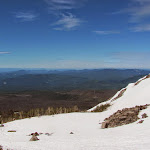
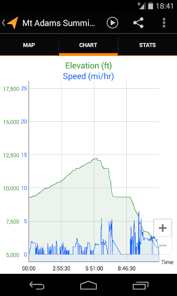
One of the coolest things about Mt. Adams is that it’s very glissade-friendly. You can slide down on your ass pretty much all the way from the summit! A lot of people will climb up with their skis or snowboards and just ski down, which is even cooler, but I’ll take ass-sliding over walking any day. This is why the GPS data for the descent looks so trippy, all the way down to Lunch Counter:
On the first chute, I actually lost control (it was pretty frozen), and a slight turn threw me out of the chute, so I was sliding down the side of the mountain, on the jagged ice. I had to self-arrest to put a stop to that. My ass got pretty scratched up from that whole thing. It was worth it for that sentence, though. :)
I maintained much better control over the rest of the glissades, and it was really nice to simply float down the mountain. What took us almost 6 hours to climb, we descended in mere minutes. Since I’m a pretty big dude, I tend to accumulate a lot of snow, and eventually, you’re just riding a controlled, mini-avalanche. I wish I had taken out my camera to record that. It was really cool! As I’d fly by climbers, I’d yell, “I am the avalanche whisperer!!!!”
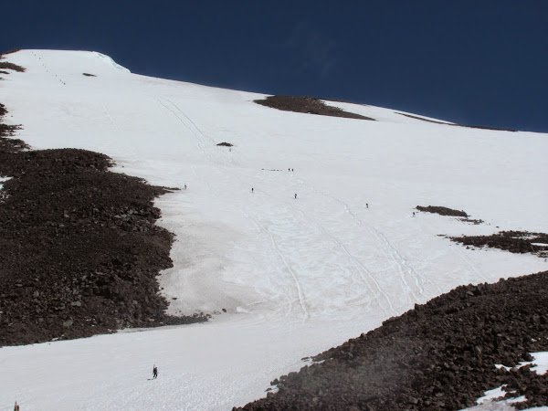
Here, you can see the glissading chutes going all the way down from Piker’s Peak. Our arses were the last thing to grace them, as of this picture!
After a longer break, and some much deserved lunch, we broke down camp and headed down, back to the trailhead. There were a few more glissade chutes here and there to help us get to where we needed to be, but by and large, it was more efficient to just plunge-step down, since it wasn’t steep enough for a very quick ride.
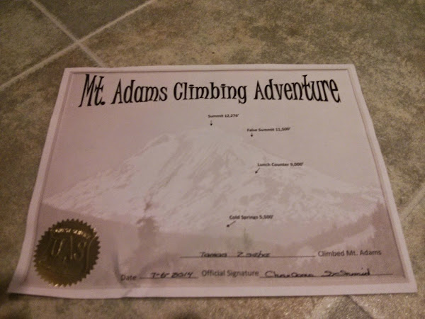
After packing up and using a real toilet again, we could go sign out at the ranger station. They also handed out certificates to those who summited, as long as we can provide picture proof. It’s kind of dumb and gimmicky, but why not, right?
This was a very well-executed trip overall, and everything worked out beautifully, especially the weather conditions. Next time around, I’d love to challenge myself to do the entire climb in a single day.
See the full album.